Monday, 22 August 2016

Charging my batteries

Wednesday June 8th and we cross the Green River on the bridge that I camped under the previous night.
In Pony Express days there was a ferry here , though the river could be forded during the drier months of the year.
From here we had to tackle a twenty-four mile stretch of remote and waterless country, following the Oregon/Pony Express Trail to Granger.  I was not particularly concerned about this as the weather was relatively cool, (in endurance events when horses are covering ground fast in average weather conditions, they rarely drink before thirty miles) but Andy kindly offered to bring some water out for the horses if he had time.
Unfortunately my camera ran out of battery, so I was only able to take a handful of photos en route, though to be honest it all looked much the same the whole day...
Andy caught up with me with water supply as promised, but by that time I had nearly reached Granger and the horses only took a sip as they had already drunk out of a puddle from the recent rain we had encountered en route!

Grassy camp spot on 'Annie's land' (now owned by Granger town) by the Black Forks river in Granger.
You can just see the horses on the right near the river, while my tent is tucked in under the trees on the left.     The only restaurant in town was closed, but by coincidence I got talking to a friendly woman who turned out to be Annie herself, and she drove me over to 'Little America'  service area to get something to eat, and I charged my batteries in the town leisure centre.
This unassuming sign stuck onto a wire fence in Granger was to salute the achievement of George Wyman who was the first person to cross America, not as I first thought on a bicycle.... 
but on a motorised bicycle. In fact he was inspired by Thomas Stevens who was the first person to cycle round the world, and whose descendant I met on the road in Missouri.

Sunset in Granger....
Lady and Mo on the morning of Thursday June 9th by South Bend stage coach station in Granger...
The Ham's and Black's Forks of the Green River join here at Granger, and fur trappers and traders passed this way as early as 1824, before the emigrants started travelling through.  Burton stated that in 1860 the Ham's Fork Pony Express station  was kept by an Irishman and a Scotchman, Dawvid Lewis and his two Irish wives, and described it as squalid, filthy and full of children.   According to him it was a dry-stone shanty built into a river cliff, and thus cannot to be the sturdy stone and adobe building in the photo above.  This was probably built around 1862 and is now a heritage site.

About fifteen miles from Granger along the Oregon/Pony Express trail we came to Church Butte, another important landmark....
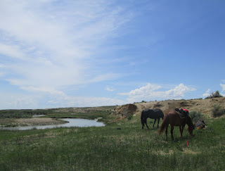
There is disagreement about the existence and location of a Pony Express station at Church Butte, but a few miles on I stopped for a midday rest by the Black's Fork river, quite by accident at a possible site. You may just be able to see the Pony Express station marker in the sage brush to the bottom right of the photo below...
I sheltered from the sun and wind under the small tree, and the horses grazed along the river bank which was lined with lush grass.  A couple of guys with metal detectors turned up who told me there had also been an army camp here during the Mormon war.  Somewhere between here and Lyman we would have passed the site of Millersville Pony Express station of which there is nothing left.   Burton describes it as a clean and comfortable ranch run by a Mormon couple.
Sheep on the road nearing Lyman... 
..which turned out to be like an oasis in the sage brush desert, with leafy trees and lush grass.
 
A long day in which we covered around thirty-four miles, but it was worth it to reach Lyman and take advantage of great hospitality at the home of NPEA member Kendall Potter in Mountain View.   The horses took full advantage of my decision to take another day off - Mo sunbathes while Lady has a scratch....
This break gave me a chance to charge my batteries again (physical, mental and electronic), plan my next few stops and organise a vet inspection for the horses' Utah health certificates. 
Kendall serves up a historic fluffy German pancake for breakfast!
...and the antelope steak for supper was pretty awesome as well.   

Thursday, 18 August 2016

Farson to the Green River

Sunday June 5th  
A long twenty-four mile tramp along the side of Highway 28 to Farson...
..though the monotony was considerably relieved when I was joined by Andy and Melissa and a group of friends who trailered their horses out to meet me...
and the horses were cheered up by the company as well.   I had repeatedly been told about the great ice-cream shop in Farson, so it was with a sense of anticipation that I arrived at the small crossroads town.....
..and I was not disappointed when we all went inside for a scoop or two. I went for the Moose Tracks with chocolate chips!
An evening ATV ride round their small ranch at the aptly named little settlement of Eden just down the road..
I had a very welcome and enjoyable day off as did Lady and Mo, and Andy and Melissa went to great lengths to give me a good time, ending up with a meal at a fabulous new Japanese restaurant Sapporo in Rock Springs.  The gang looking a bit fuzzy after a jolly night out...

Melissa in the middle with me, Andy at the back with the dashing black cowboy hat, friends Raylene and Ann and spouses as bookends.
Tuesday June 7th and it was back to Farson to rejoin the Pony Express Trail for the twenty-five mile leg to the Green River crossing..
Emigrants travelling through South Pass and following Pacific Creek (past the site of Pacific Springs Pony Express station) would have found themselves crossing the Big Sandy river at this point, so it was a natural site for a stage and Pony Express station.  Big Sandy station, which was managed by a Mormon couple, was just upriver of the present bridge to the right of the photo.
 This section of the trail has much of historic interest, particularly in terms of Mormon history.  This monument is to commemorate a meeting near this point on June 29th 1847 between Brigham Young's pioneer group and experienced mountain man Jim Bridger.
 In the words of the plaque, both companies "conferred at length  regarding the route and the possibility of establishing and sustaining a large population in the valley of the Great Salt Lake.  Bridger tried to discourage the undertaking. In this conference he is reported to have said that he would give one thousand dollars for the first bushel of corn grown in the Salt Lake valley."  Not sure if they ever got the thousand dollars.

We were now on open range, and endless signs warned travellers to be aware of the myriad of animals that roamed the ranges apparently intent on flinging themselves under vehicle wheels if not horse hooves.  If it was not sluggish cows.....
 it was speeding antelopes..
not to mention sage grouse, who in spite of their name are seemingly not wise enough to obey the Green Cross Code...

Another monument, this time to an incident in the Mormon or Utah war of 1857-1858 in which twenty-three US army supply wagons led by Capt. Simpson were burned by Major Lot and 43 Utah militia under orders from Brigham Young.
The war, in which no-one was killed or wounded in conflict, was largely muscle flexing on both sides caused by conflicting concerns of the US government and Utah under Brigham Young, and was eventually resolved by peaceful negotiation.
Stopping for a break by the Big Sandy near the probable site of Big Timber Pony Express station...
 
The willows mentioned by Burton have long gone.  The river really was full of sand, and I kept the horses away from the water in case of quicksand.
Following the Oregon Trail/Pony Express Trail along the valley of the Big Sandy...
It was somewhere along here that Burton recorded that they met and talked to a Pony Express rider.
 
Re-joining highway 28 I had a nasty few moments when a thunderstorm with some serious forked lightning suddenly brewed up right alongside me while we were the only prominent features on the plain. Added to this the gate by the cattle grid off the open range was locked, and I panicked slightly until I realised I could open the fence alongside.   We descend with relief down to the valley floor by the Green River while the storm thankfully disappears into the background....
There were still ominous clouds lurking around waiting to pounce when we reached the river, so I made the decision to camp under the bridge where hopefully I would be protected from any stray lightning bolts should the clouds have a temper tantrum.
The Pony Express station was most probably on this side of the river. Both Burton and Mark Twain commented on the good food here.  Besides coffee, Mark Twain had hot biscuits and fresh antelope steaks for breakfast, a far cry from my squashed granola bar.
However local NPEA ride captain Howard Schulz turned up with some horse feed which was gratefully received.

Crossing the Divide

I had been concerned about the stretch of road which lay ahead between the last crossing of the Sweetwater and Farson, as there did not seem to be access to water or decent grass for miles. NPEA member Melissa Misner had promised to help out, and I was delighted when she turned up at the Atlantic City Mercantile with husband Andy in tow to plan ahead.  So I was feeling much more confident when we set off the next morning Saturday June 4th after a hearty American breakfast at the Miner's Grubstake..
As we came down into the former gold mining town of South Pass City a few miles further on we passed the old Carissa goldmine....
This became Wyoming's principal goldmine after the Carissa lode was discovered in 1867.  It followed the usual boom and bust cycle, closing and re-opening several times before eventually closing permanently in the 1954.  Then in 2003 it was purchased by the State of Wyoming, and has been incorporated into the South Pass historic site.  It is in the process of a major restoration with repair and installation of working machinery, and it is already possible to book onto set public tours. 
 
Entering another great mining megalopolis...
It appears that the title of 'city' is a death knell for any town with pretensions in the west of America.
 
 South Pass City grew rapidly to a population of around two thousand as a direct result of the local gold mining boom of the 1860s, although there was already a stage and telegraph station here. Like nearby Atlantic City, the town soon fell into decline. and the population had fallen to around 100 by the mid 1870s.  Over the years the town deteriorated further and the last pioneer family moved out in 1949 to leave it as a ghost town. 
However in 1970 it was added to the register of National Historic Places, and many of the historic buildings have been preserved and restored to an impressive degree.   The main street with the Carissa saloon on the right, unfortunately not serving cold beer...
though you can buy sarsaparilla in the general store.
The interiors have been carefully furnished appropriate to the age of the building, and I particularly enjoyed wandering round the hotel in which every room has been fitted out in relevant style.
A house interior..
 So annoying I can't tweak the crooked picture straight.
 
 Crossing the dry sage brush prairie, we come to a reflective oasis down the trail...
 Are we nearly there?...
Lady and Mo at our last crossing of the Sweetwater river before the last haul up hill to South Pass.
 
South Pass is hugely significant in the history of emigrant movement in the west.  A broad open saddle which forms a low dip in spine-like barrier of the Rocky Mountains, it became vital as a crossing point and gateway through the Rockies for major pioneer trails such as the California, Oregon, Mormon and Pony Express.
For me it was also momentous in that it marked my arrival at the Continental Divide separating the drainage systems of the Atlantic and Pacific oceans ...
From now on all the water on the land I rode across (excepting that draining into the inland sea of the Great Salt Lake) would empty into the Pacific, the first time since I rode through China many moons ago.  From the point where we were standing it would slowly seep into Pacific Creek, then run into the Green River and Colorado river and out into the Gulf of California.
 
Andy and Melissa met me at a layby another nine miles along Highway 28 at the 'False Parting of the Ways' where the Oregon and Pony Express trails crossed.   They brought water and feed and I was able to camp inside the fence on BLM land.  Red sky at night as I settle down in my tent.. 

Wednesday, 17 August 2016

There's gold in them thar hills

Thursday June 2nd  and Elder and Sister McLean come to see me on my way.. 
They had taken me under their wing during my stay, giving me a lift to Riverton to shop and join them for a meal, and inviting me for breakfast in their RV.  Visitor centres such as this are manned by LDS members who are often retired professionals.  Interestingly Sister McLean was descended from Welsh emigrants.

From here I took the isolated Hudson-Atlantic City road, a gravel track crossing some remote and beautiful country..
 
A view towards the infamous Rocky Ridge on the horizon, where the Oregon trail runs...
....in the middle distance is a Sage Camp, a Mormon site used by handcart trekkers. 

I eventually reached Diamond Springs, where I pitched my tent on a bleak hillside in a gale, the reason why the tent is cowering behind the piece of fencing on the right....
..not ideal, particularly as grazing was sparse and Lady's tether kept getting wrapped round the sage bushes.
 On google earth I had identified a small grove of trees as a possible camp spot, but on the ground it seemed inaccessible and distant behind a patch of boggy ground. (just below the horizon on the photo above)  Luckily I decided to do a recce on foot and found a track through the bog to the idyllic sheltered camp spot below. The horses were a bit miffed to be loaded up again, but were far happier in their new lodgings.  The video clip was taken in the morning when the wind had abated.  My first choice of camp spot was beside the reservoir in the distance.
Friday June 3rd.
A distant view of the Wind River range from the Hudson-Atlantic City road ..
An abandoned pick-up in the middle of nowhere?...
 ...in fact transport for a ranchers' four wheeled friend, the ATV.

Home home on the range, where the deer and the antelope play..
Arriving at the bustling metropolis of Atlantic City..
Atlantic City was founded following the discovery in 1867 of large gold deposits in the hills around South Pass, which contain Wyoming's principal gold bearing greenstone belt.  Miners flocked to the area and the population of Atlantic City rose rapidly to around two thousand, but boom was soon followed by bust as placer gold ran out and large gold deposits failed to materialise. Mining activity gradually petered out over the years and Atlantic City became the small backwater town it is today, mainly catering for holiday makers and hunters.
 Checking in at the Atlantic City Mercantile, originally built as Geissler Store in 1893 and now a well patronised steak house and saloon...
 ..it boasts an amazing bar reputedly transported from a former whore house in Hudson City and a great place for a cold beer after a long ride on a hot day....
...at the end of the bar you can just see Connie who kindly donated a bale of hay for the horses. Having covered a thousand miles since St Joseph, I decided to treat myself to a holiday cabin owned by the Miner's Grubstake next door, and the horses had a corral right behind.


Tuesday, 16 August 2016

The Biggest Bust of them All

Tuesday May 31st  The Split Rock Ranch has two bases, the other one sited on the main 287 highway and enigmatically called Split Rock Ranch 'the Block'. As I was rejoining the highway, Miles invited me to call in for the self serve breakfast provided in one of the cattle barns for all the cowboys working on the ranch.  So here are Lady and Mo waiting patiently..
 ...while I tuck into biscuits and gravy washed down with numerous cups of coffee.....
 This was probably near the site of the Split Rock Pony Express station which lay south of the Sweetwater river. Split Rock was another noted landmark on the emigrant trails, and you can just see the cleft on the horizon to the right of the Split Rock heritage marker below.....
This was on highway 287, another boring plod though I was sometimes able to ride along the wide grassy verge, keeping an eye out for more rattlesnakes.
 The Green Mountain Herd Management Area (HMA) lies to the south of the highway here.  This is one of several BLM ( Bureau of Land Management) administered areas of public land which sustain a population of wild horses or burros.  The Green Mountain HMA encompasses around 88,000 acres with around 300 wild horses or mustangs.  This lone horse I saw on land to the south of the highway was probably a mustang colt...
My destination for the day was Jeffrey City, where I found a place to park the horses and camp behind the Split Rock Café, a sort of Wild West greasy spoon with a gloomy bar and friendly staff... 
 Jeffrey City has a proud boast in its claim to have the biggest bust of them all..
...sadly not belonging to the wild west barmaid at the Split Rock cafe, but resulting from a crash in the uranium market.  A sleepy little community with the cosy name of Home on the Range originally existed here.  Following the discovery of uranium nearby in 1954 the tiny settlement was given the ambitious name of Jeffrey City, and the population mushroomed to around four thousand by 1980. But after 'the biggest bust of them all' in the early 1980s the town declined rapidly and there are now less than a hundred people living here.   
A couple of rather forlorn places of worship survive.  The Shepherd's chapel housed in a garage...
 ...and St Brenden's Catholic church in a shed.
 The main excitement of the day Wednesday June 1st as I rode away from Jeffrey City was a plume of dark smoke which appeared behind me...
 ..eliciting a constant stream of fire engines, police cars and ambulances for the next hour..
 ..but I never did find out what it was all about, and returned to my monotonous tramp up the highway...
 Stopping at Ice Slough, where there was once a Pony Express way station about a mile to the north.
The ice slough was a marshy stream which remained frozen until late summer so ice could be found by digging beneath the surface. The emigrants were able to use this as a welcome source for cooling drinks and preserving meat. This is not possible today due to draining of the slough, or slew as they pronounce it here.
Arriving at Sweetwater crossing,
The Pony Express trail crossed a little further upstream from this point, and then followed the course of the Sweetwater up to South Pass. We would be taking a parallel route slightly further north, but for the moment we needed to find a place to stay for the night.  The Mormon Sixth Crossing Handcart visitor centre is located here and the volunteers found a corner of a field for the horses and my tent.
The centre is devoted to commemorating the ordeal of the Willie Handcart company which left Florence only two weeks ahead of the Martin company'  They were further west by the time the winter snowstorms struck, but company members were already dying as they struggled to Sixth Crossing. A few miles further west they were met by an advance rescue party, but their torment was not over. As they battled over Rocky Ridge in a fierce blizzard the next day (October 23rd) thirteen more emigrants perished. Survivors of the company reached Salt Lake City on November 9th by which time sixty-eight men, women and children had lost their lives.  Altogether the death toll in the handcart disaster was two hundred and thirteen.
 
A common sight at such visitor centres along the Mormon trail are long rows of replica handcarts lined up ready for action...
...as a popular Mormon pastime is to re-enact the sufferings of their forbears by pulling and pushing handcarts around the country on handcart treks, although it has to be said that the modern experience is considerably more cheerful.